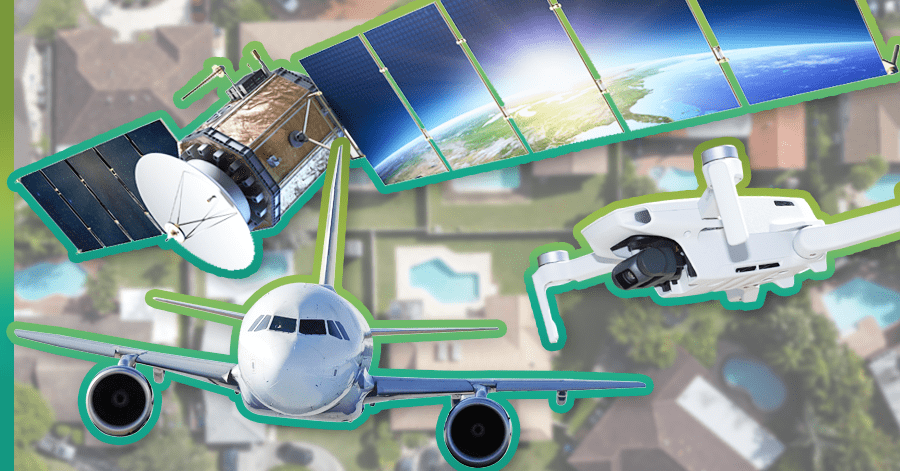
A high altitude look at satellite, aerial, and drone roof imagery.
There are three main sources for photographic overhead images — satellites, airplanes, and drones. Hi-tech roofing contractors use one or more of these image sources depending on what software and hardware applications they’re equipped with. Without ready access to overhead, digital images, and a roofing application to maximize their use, contractors must depend on manual measurements to create a professional roof report.
This article examines the three major types of overhead imagery, and advantages of each.
Satellite Images
Since Russia’s Sputnik satellite launched in 1957, approximately 8,400 satellites have been sent into “low Earth orbit,” just far enough away to escape the planet’s gravitational pull. In July 1972, we began sending satellites into space specifically to acquire images of Earth. The first of these was the Earth Resources Technology Satellite, also known as LandSat 1. It was the precursor to the satellites that now power various mapping applications such as Google Maps.
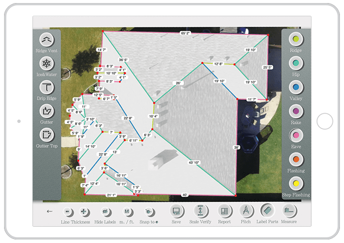
Software developers, like iRoofing have created tools that can integrate with satellite images for the purpose of streamlining construction projects and making certain traditional tasks safer, cheaper, and easier. iRoofing enables contractors to create an unlimited number of roof measurements and estimates accurately, without having to visit job sites.
Satellite Images: What to Applaud...
Thorough Coverage Area | Remote Task Completion
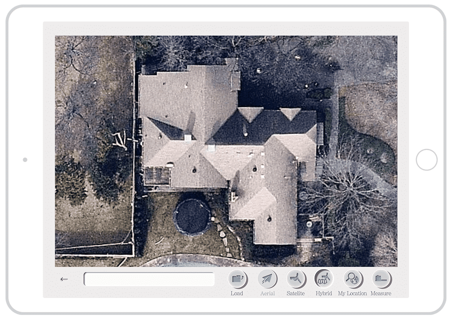
Just type any address into Google Maps or Apple Maps and you’ll quickly see that satellite images are available for just about any home or commercial building in your service area. In fact, the entire surface of the Earth is captured by satellite images. If you know the longitudinal and latitudinal coordinates of any location, you can zero in on it through the technical “magic” of satellite imagery. With roof measurement software, a roofing professional doesn’t necessarily need to visit the property he or she is bidding on. A complete and accurate roof report and project estimate can be done before ever meeting the client on their property.

Satellite Images: What to Think About...
Conditions When Image was Captured
Satellite images are periodically updated, but the time span between updates can vary. This means that when you access a satellite image on your computer or mobile device, the image you get was taken at some indeterminate time in the past. Even if the image is just a few months old, seasonal conditions at the time the image was captured could spell problems in the form of leafy foliage obscuring parts of the roof. The image may also predate building add-ons. Weather may have interfered with capturing a clear view, as well.
With satellite imagery, seasonal obstructions, recent add-ons, and weather factors make accurate measurements more challenging because you can not decipher roof parts clearly.
Satellite Images: The Bottomline...
Rarely will you ever come across a property that can not be seen with adequate clarity from a satellite image. But, if you ever have an issue with a satellite-generated image, there are easy ways to measure remotely. With iRoofing, you can switch from satellite images to aerial images with the tap of a button. Likewise, you can easily upload a drone image or blueprint into the app whereby you can quickly, accurately measure from those sources.
By performing roof measurements and estimates remotely with satellite imagery, roofing pros save time and avoid the expense of driving back-and-forth to a job location, until they really need to.
Aerial Images
High-resolution aerial images have been a game-changer for hi-tech roofing contractors. The clearer an image, the faster and more accurately the roof can be measured. Aerial overheads are exactly what you might guess they are — images taken from airplanes. All-day, everyday specially-equipped aircraft are crisscrossing the skies above populated areas or areas important to observe from above due to the presence of industrial and agriculture operations. Naturally, aircraft overflights can acquire superior imagery compared to satellites which orbit at about 250 miles above Earth. With high-resolution aerial photography, the same technology is used to integrate the visual data with mapping locations, so you can access an aerial image of a property address just like you can a satellite image on Google or Apple Maps.
Aerial Images: What to Applaud...
Clear Images | Flexible Dates | Remote Task Completion
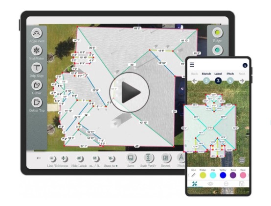
When a satellite image is obscured by bad weather or leafy trees, or if it’s fuzzy and you can’t decipher a hip from a valley, switching to aerial, high-resolution imagery can instantly relieve your headaches. iRoofing builds aerial image technology into its app with a feature called Clearoof™. This feature not only lets you see a roof surface with 4-times the clarity of satellite imagery, it also lets you choose from a variety of capture dates. If the most recent image capture took place when the view of the roof was obscured by the leafy trees of springtime, simply choose a date from the wintertime when the trees were bare. The number of date options varies from property to property but you will invariably have multiple options to select.
To-date, specially-equipped aircraft have captured clear images of 71% of U.S. residences, including 430 urban areas. iRoofing is currently the only roofing software that integrates multi-seasonal, high-resolution aerial imagery into a portable, do-it-yourself roof measurement, estimation, and presentation solution. Check out this video to see how Clearoof™ can bring a unique benefit to your roofing company.

Aerial Images: What to Think About...
Full Coverage of North America is Still in the Works
Today, Clearoof™ accounts for about 71% of addresses across the U.S. Because Clearoof™ encompasses 432 urban areas, most roofing contractors will be able to access high-resolution overheads for their roofing jobs.
Currently, Clearoof™ is limited to the U.S. In time, Canada will be well documented, too. Clearoof™ aerial photography is included with all iRoofing subscriptions.
Aerial Images: The Bottomline...
Accessibility to aerial overhead photography has proven to be extremely useful to contractors in all areas, especially regions with pronounced seasonal changes. The option of choosing imagery based on past months ensures that roofing pros can measure from a clear, unobstructed overhead image, leaving virtually no reason for a them to spend money on 3rd-party roof reports. The fact that ample allotments of Clearoof™ credits are included in iRoofing’s subscription price, gives hi-tech roofers a distinct advantage that few competitors can match.
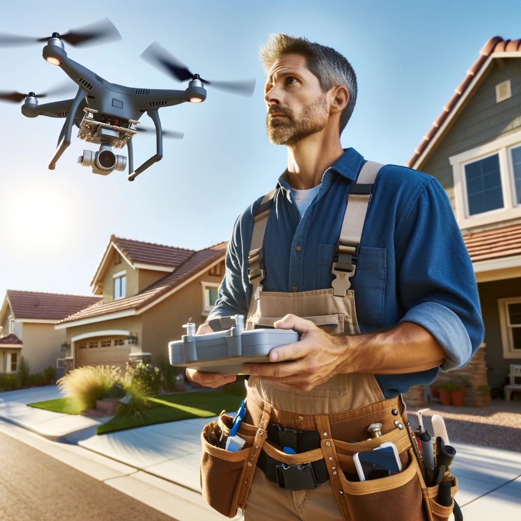
Drone Images
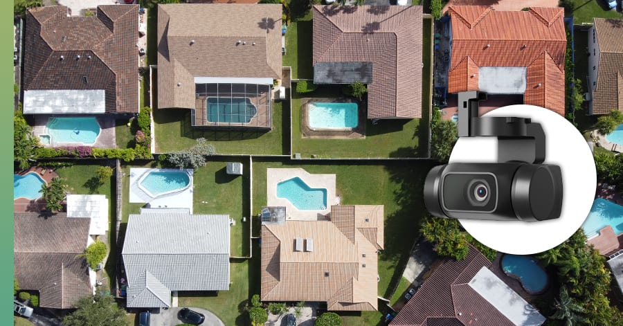
Another way to capture clear, high-resolution aerial images is with a drone. Flying a drone over a property puts you in control of capturing the images you need and taking video that can contribute to a fantastic client presentation. When you have roofing software, like iRoofing, you can combine drone imagery with satellite or aerial imagery to create proposals that knock the socks off homeowners and property managers.
Drones are not only effective in capturing high-resolution overhead images, they can also give you the oblique angles you need to clearly distinguish roof conditions and examine complex roof parts, such as overhangs and penetrations.
Drone Images: What to Applaud...
By using roofing software, drone imagery is integrated seamlessly into your roof measurement reports, estimates, inspection reports, and iRoofing’s roof simulator tool. Uploaded images are stored directly into the in-app CRM tool for reference anytime.
As with Clearoof™ imagery, when satellite images are insufficient, drone images are a great option.
When a roofing pro is equipped with a drone, it makes a positive impression on property owners, especially when contractors incorporate drone photography and video into a professional, digital roof proposal!
Recently, iRoofing began recommending the Mavic Mini by DJI, the world’s leading drone manufacturer. Read all about the Mavic Mini and the advantages of using drones for your roofing jobs… click here.
Drone Images: What to Think About...
On-Site vs. Remote Measurement Solution
The main difference between a drone versus satellite or aerial images is that drones are not a means for performing remote measurements or estimates. You obviously need to visit the property and get the permission of the homeowner to fly the drone above their property. Nevertheless, the crisp overhead images, oblique images, close-ups and dramatic video you are able to capture with a drone make owning one very worthwhile for any contractor!
Drones are fun and easy to operate; plus, roofing contractors can acquire a drone at a reasonable price, but drones generally require registration by the owner/operator.
Drone Images: The Bottomline...
Drones can be indispensable in areas not well served by satellite and aerial images. If satellite images are unclear and Clearoof™ isn’t available for the address you need, a drone is the next best thing. As with remote aerial and satellite measuring, drones offer a safer option than climbing onto a roof. Plus, using a drone instills confidence among property owners because it communicates a contractor’s level of expertise, technical know-how, and the value they place on safety.
Hi-Tech, High Flying Roofers Rule!
Whether your company relies on satellite, aerial, drone or all three forms of roof image capture, you’re among the elite, hi-tech contractors of the construction industry. You also realize that the money you invest in technology quickly pays you back in spades!